Feb
6
Glacial Lake Missoula Bears Prehistoric Traces
February 6, 2015 | Leave a Comment
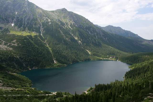 The Glacial Lake Missoula is not a lake any more rather evidence to what had been an outsized lake until the pre-historic ice age flood. The site occupies a vast six hundred and thirty five acres of territory of the Sanders County. It got the name first in the year 1966.
Around a dozen of a thousand years ago, Glacial Lake Missoula had water to a depth of two thousand feet and the space it occupied was equally great as Lakes Erie and Ontario combined. There occurred catastrophic flood blustering out the ice dam of the lake allowing more than five hundred cubic miles of water to drain towards the west with a force equal to that of no less than sixty Amazon Rivers.
Visitors who’ve arrived at Glacial Lake Missoula can still have a view of the lake’s shorelines in the sedimentary lines across the two mountains that stand at the spot, namely Mount Jumbo and Mount Sentinel. The uppermost identified shorelines are at an altitude of four thousand feet.
The site stuns the visitors to a tremendous intensity leading them to imagine the lake existing today at that level which would have made summits of the two mountains look like two islands. It also amazes them when they think of the city they’ve come to visit; that would have been fifty less than a thousand feet beneath lake water.
Apart from the shorelines, the visitors can also spot boulders scattered throughout the Glacial Lake Missoula. Some of them are as big as a compact car while the smallest ones are sized similar to a human skull. Today, the site is home to the city’s inexhaustible drinking-water aquifer.
If someone loves either history or nature, or simply loves viewing purely miraculous sites, one shouldn’t miss out a tour to Glacial Lake Missoula.
Photo Information: This photo is provided by and given credit to piotrpazola – on Flickr.com with permission via Creative Commons Licensing.